South Swells Bring Great Waves to SoCal Beaches
South Swells Bring Great Waves to SoCal Beaches
Dust off your old marine map and look for the golden window for storms and hurricane swells to approach SoCal from the South to the North. There is a traditional golden window that hurricanes or large storms can transverse or track to giver surfers a sweet challenge.
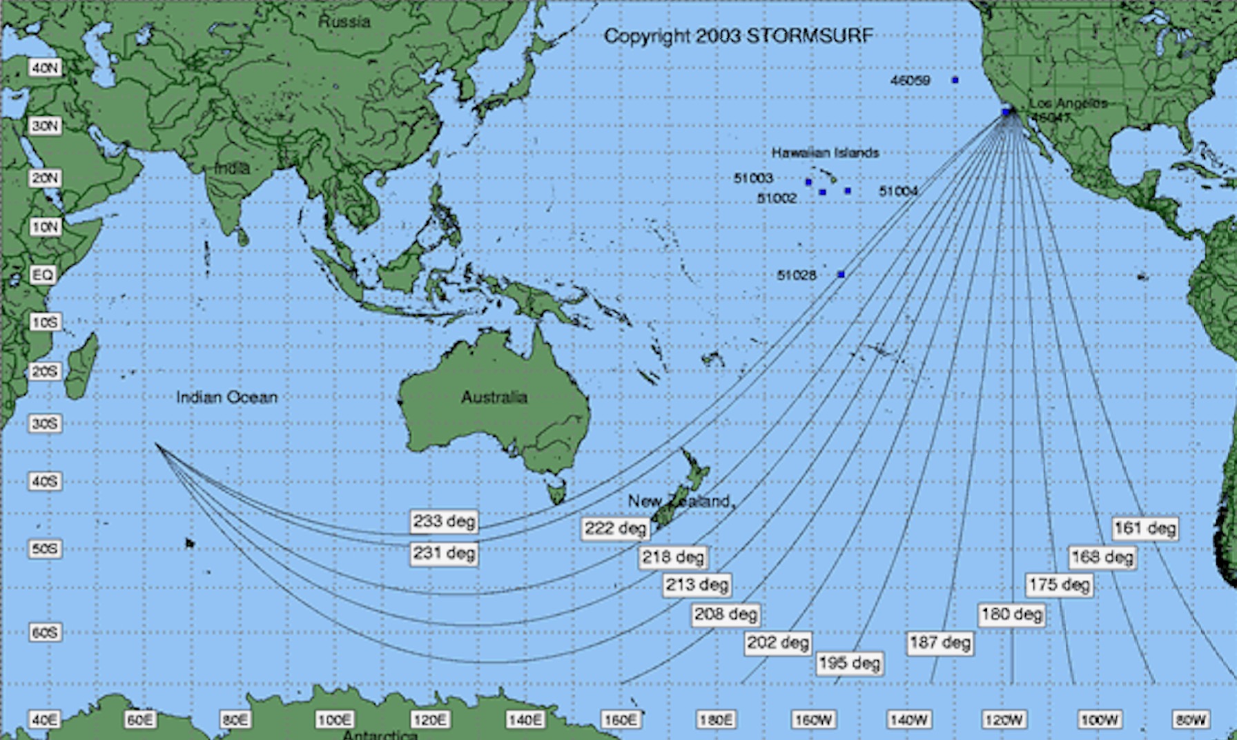
If conditions are right, storms and hurricanes move a due north direction into the golden window. This happens when storms track between a 156°-180° range or simply put, South to North.
The key to understanding a golden window swell is to understand conditions; most of SoCal topography as a rule, faces SW, with many stretches of coast even facing due south. Look closer at the marine map and you will see the western coastline of California and below generally sweeps back to the SE as you travel southward down the coast of America.
Eastern Pacific hurricane season runs normally from May 15th to November 30th. Hurricanes are like giant engines that use warm, moist air as fuel. That is why they form only over warm ocean waters near the equator. The warm, moist air over the ocean rises upward from near the surface. Because this air moves up and away from the surface, there is less air left near the surface. Another way to say the same thing is that the warm air rises, causing an area of lower air pressure below. Cold water is a major factor preventing hurricanes from striking the pacific coast. It prevents or stops the engine that needs warm, moist air as fuel. A cold ocean current that flows from the north southward along the coast of Washington, Oregon into California.
Our hurricanes that form north of the equator spin counterclockwise. Storms south of the equator spin clockwise. This difference is because of Earth's rotation on its axis. The hurricanes that develop in the North Pacific Ocean generally blow the storms away from the land out to sea.
At best for SoCal, hurricane swells can only hope that the hurricane keeps that golden window track as long as it can before it moves to a NW track. Why, in the Pacific Ocean, the North Pacific Current flows from Japan eastward across the Pacific and then splits into the northern-flowing Alaska Current and the southern-flowing California Current. The cool-water California Current, which sweeps down the West Coast of the United States, really acts as hurricane repellant, protecting California and even Northern Baja California from hurricanes.
The other factor in the mix for SoCal is the upper-level winds, which tend to carry and guide storms to the West and Northwest, away from California, and also tend to cut the tops off of hurricanes, fragmenting them apart. With the upper and lower-level winds, there's a lot of wind shear (cutting / reducing) off the coast here in Southern California. These prevailing northwesterly winds also push warmer surface waters offshore, drawing cooler waters up to the surface, and this further adds to the cool nature of the nearby ocean waters that would weaken any storms that did approach California.
Our best bet to get this golden window track is to have nature cooperate but at least hope for a long enough hurricane track to bring it close enough for long swell periods and decent swells. Hurricanes can get close. How? First, we would need an El Nino event, which warms waters off the coast or when California has warm water periods about every five to 20 years.
Second, California’s upper-level winds would have to help steer an unusually strong storm our way, however because much of California sits atop bluffs, above sea level upper level winds help steer storms away.
The golden window track can produce golden swells as they are sent by tropical systems or storms off South America, off of Baja or the Antartica. The key is to have them go on a northerly track into that golden window between 156°-180°.

Tropical Storm Dalila, End of July 2019
Looking at your marine map you can see the coveted golden window track has fewer islands, sea mounts or shallow areas for the swell to produce Island Shadowing and refract around islands (or bend towards / around). In review, Island Shadowing Is the effect of blocking and reducing of a swell when they are heading through neighboring islands. As buoys predict a much larger swell, islands will block and reduce the swell significantly. When Island shadowing is fully in effect a good rule-of-thumb is the swell is reduced by at least 50 percent+ of its energy (swell height and wave consistency).
Island Shadowing can make a swell less consistent with wait times, this is one reason why we wait in the line up. There could be other reasons like tide, how the fetch (large storm) moved around or how the fetch winds were consistent.
Waiting for that golden window conditions to be just right will happen usually in the Summer. With the correct conditions mentioned above, South summer storms and hurricanes could move in the due north direction into the golden window. If that northerly move continues then storms could track between a 156°-180°. But wait there is more conditions to consider, like warmer waters and helpful winds helping these storm swells to come closer to SoCal